My friend John Gregory and I went on a trip to Mexico (02/19/05 - 02/27/05) to climb two volcanoes and to do some rock climbing. Here are some highlights:
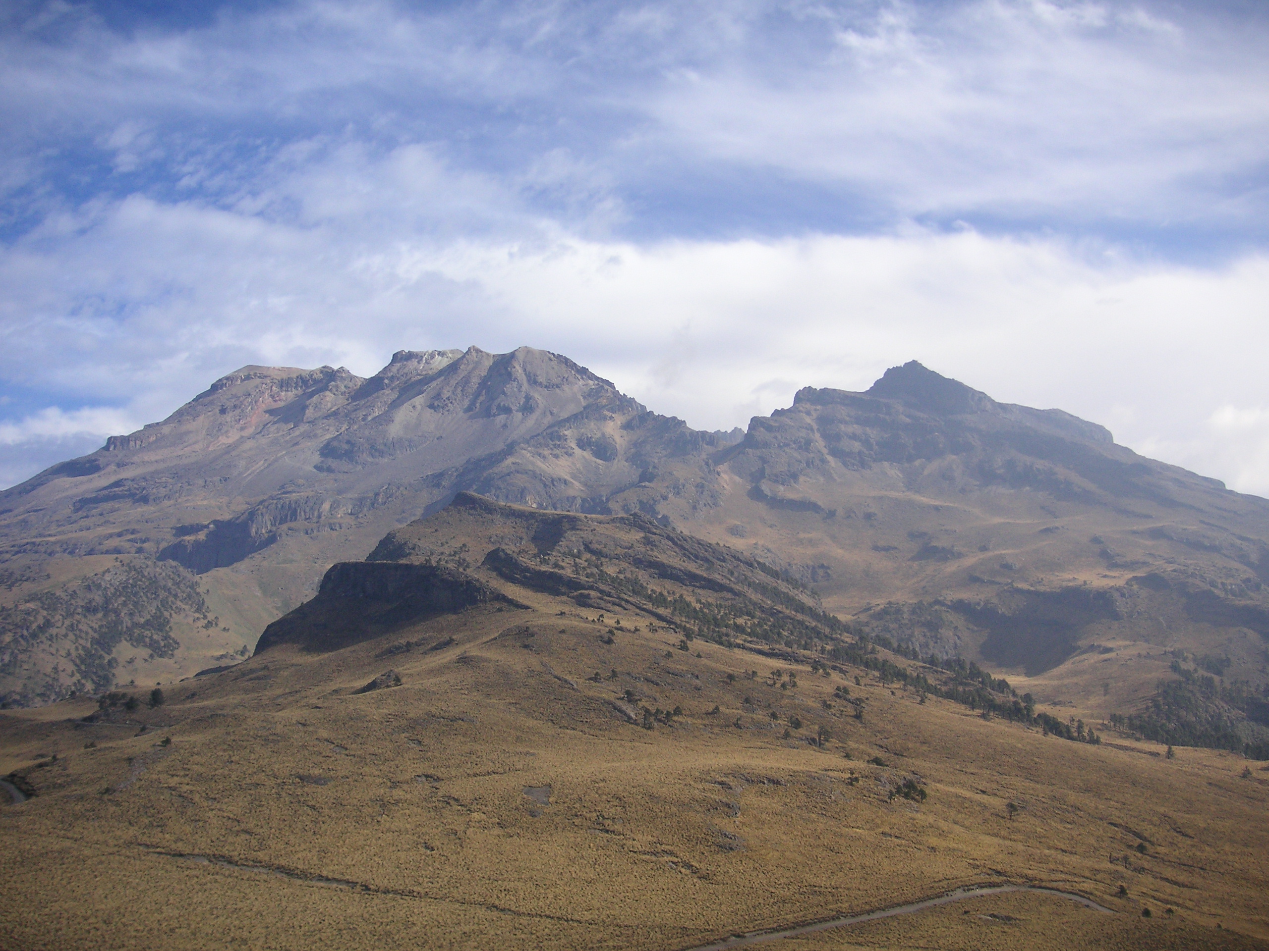
Monday, 02/21/05, 9:21 a.m., at about 13,000 feet. This is Iztaccihuatl ("Izta" for short), the first mountain we are to climb, taken from just outside our hut at the Altzomoni microwave towers. We started hiking from La Joya (12,926 feet) with our full packs around 10:30 a.m.
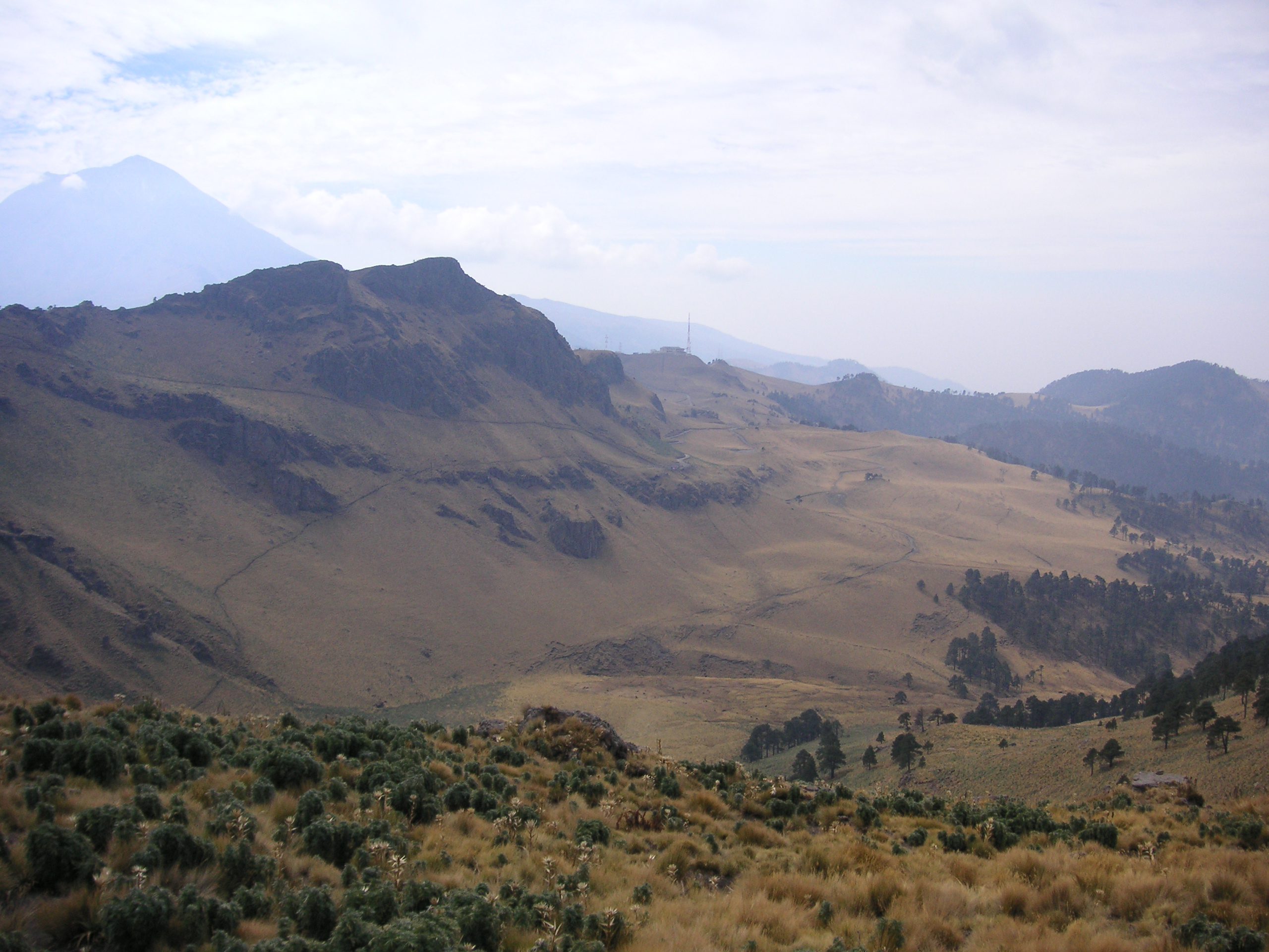
Monday, 02/21/05, 11:04 a.m., around 13,500 feet, at the shark cave (not shown). This is looking back down the trail we just came up; you can see part of the trail in the bottom left; the Altzomoni towers are in the middle, and you can see Popocatepetl ("Popo" for short) in the upper left. No one can climb Popo right now because it is currently active (volcanically speaking).
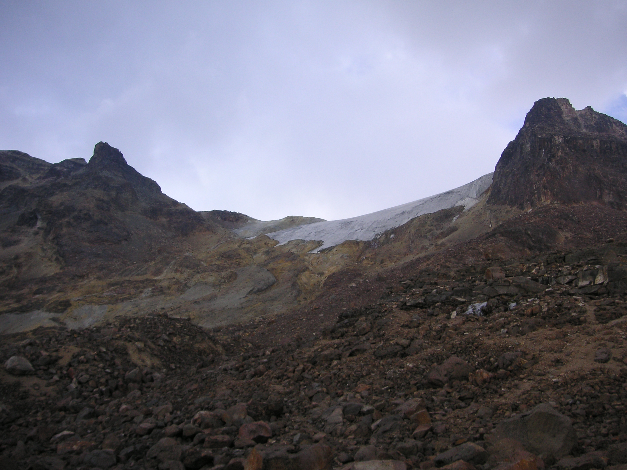
Monday, 02/21/05, 3:41 p.m., at 14,862 feet, at the Ayoloco hut. We arrived at our high camp around 2:30 p.m. This is a view looking up at the Ayoloco glacier, where we will go in the morning.
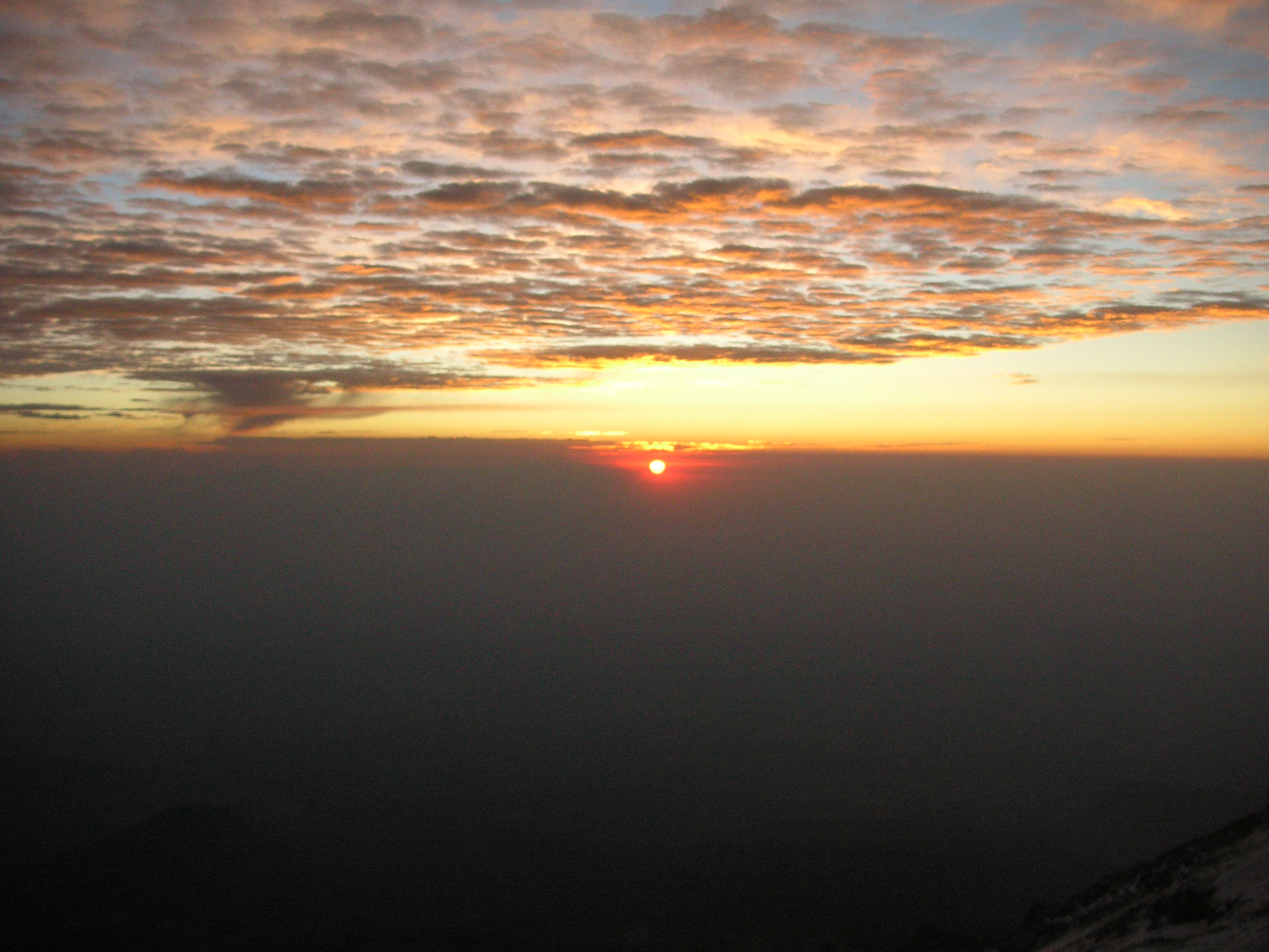
Tuesday, 02/22/05, 6:55 a.m., sunrise at about 17,000 feet. We got up at 3:15 a.m. and left camp with our summit packs a little after 4:00 a.m. We stopped on the ridge to take this picture just after sunrise.
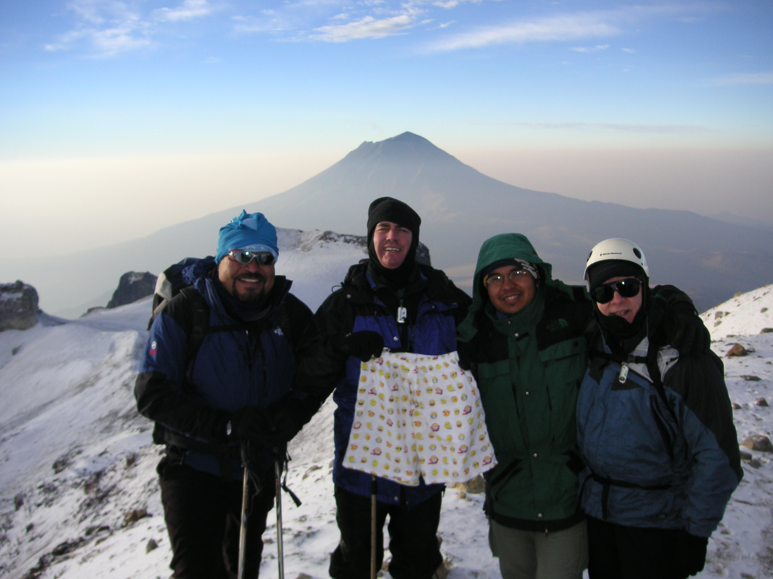
Tuesday, 02/22/05, 7:29 a.m., around 17,100 to 17,300 feet (several figures are published for the height of this mountain). This is Roberto ("el oso"), John, Alfredo, and Steven at the summit of Izta with Popo in the background. We arrived at the summit a little after 7:00 a.m., just less than 3 hours after we started from the Ayoloco hut camp. Not sure what the deal is with the boxers John is holding; I guess this is his "summit flag".
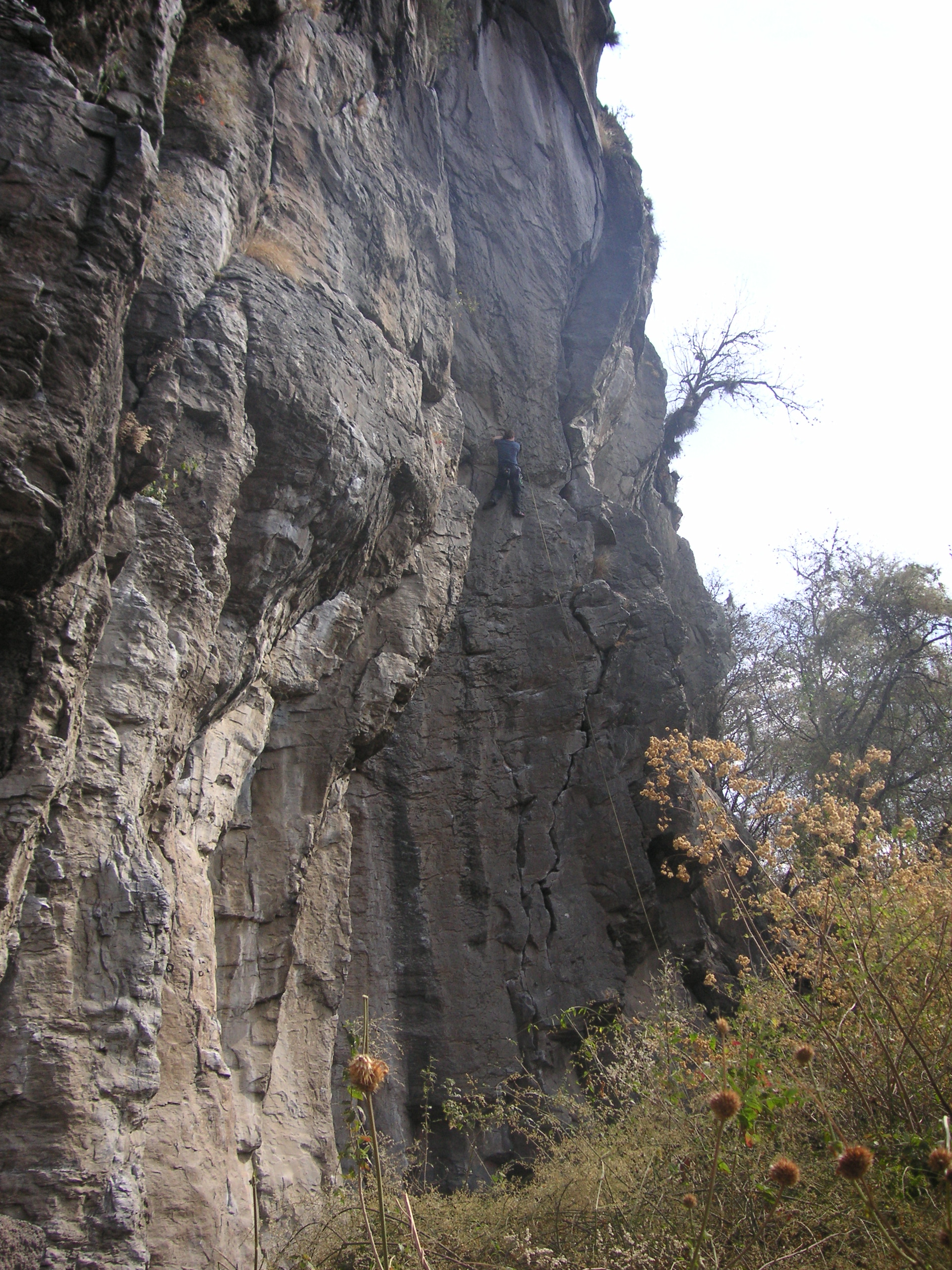
Wednesday, 02/23/05, 3:31 p.m. On Wednesday, we took a day off and went rock climbing at Los Pericos (the Parrots) a bit outside of Puebla city. This is me cleaning the eighth and last climb of the day on a route called La Tamalera, 5.11- (the tamale maker).
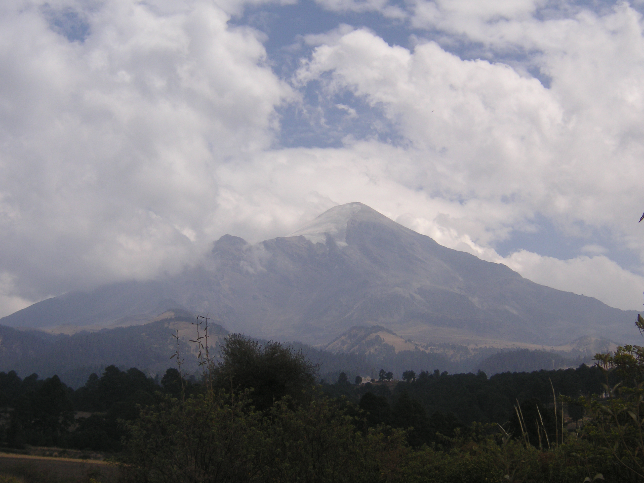
Thursday, 02/24/05, 1:15 p.m. around 9,000 feet. This is the big one, El Pico de Orizaba, about 18,400 feet (again, several figures are published for the height of this mountain). This picture was taken from the road on our way from Tlachichuca to the Piedra Grande hut. Note the big glacier on the left side of the mountain which is called the Jamapa glacier (and note there is no snow on the right side of the mountain).
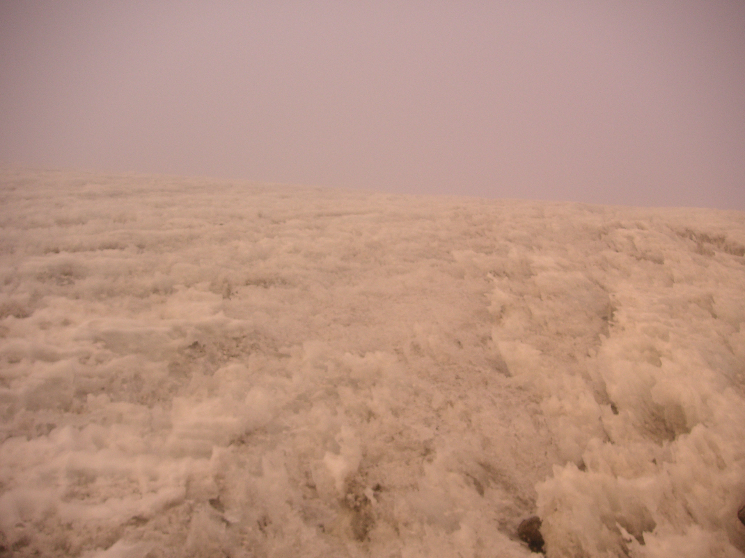
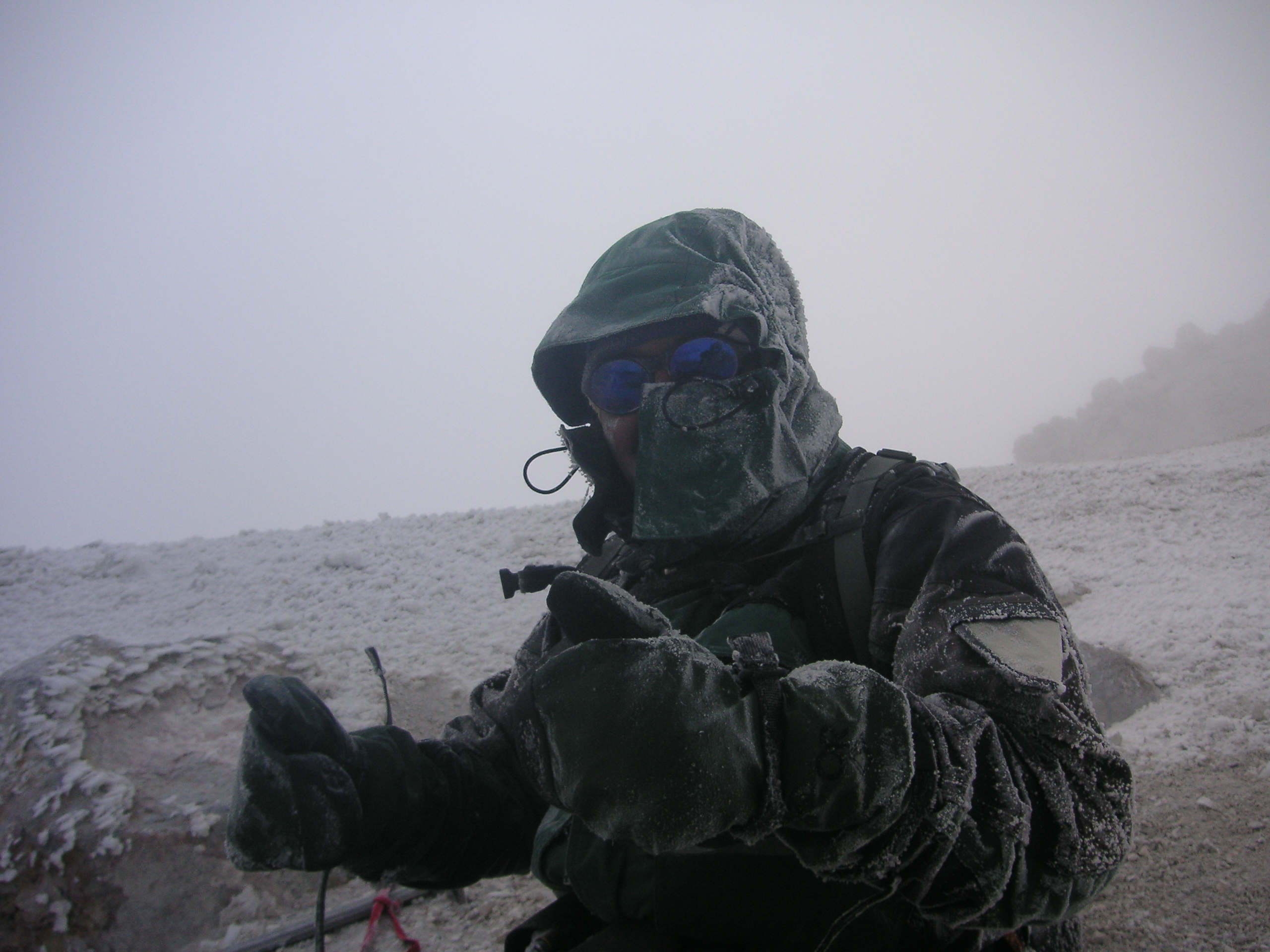
Saturday, 02/26/05, 6:52 a.m. at about 16,500 feet. Our plan was to do the summit attempt on Friday, but when we woke up at 12:15 a.m. (and again at 2:15 a.m. and 4:15 a.m.), our guide decided that the conditions were too windy to try for the summit (too bad we did not go anyway as it turns out Friday was a better day than Saturday). When we woke up at 2:15 a.m. on Saturday, the wind was just as bad, but since this would be our last chance to try for the summit on this trip, we decided to go see how far we could get. We left the Piedra Grande hut (about 14,000 feet) a little after 3:00 a.m. This is a picture of the base of the Jamapa glacier looking up in the direction we are going to go. We stopped here around sunrise to put on our crampons and rope up. As you can see, the glacier is not smooth snow but instead is a jumble of jagged, brittle "penitentes". The visibility here is about 200 feet. The high winds and the uneven ground made for, shall we say, a challenging day.
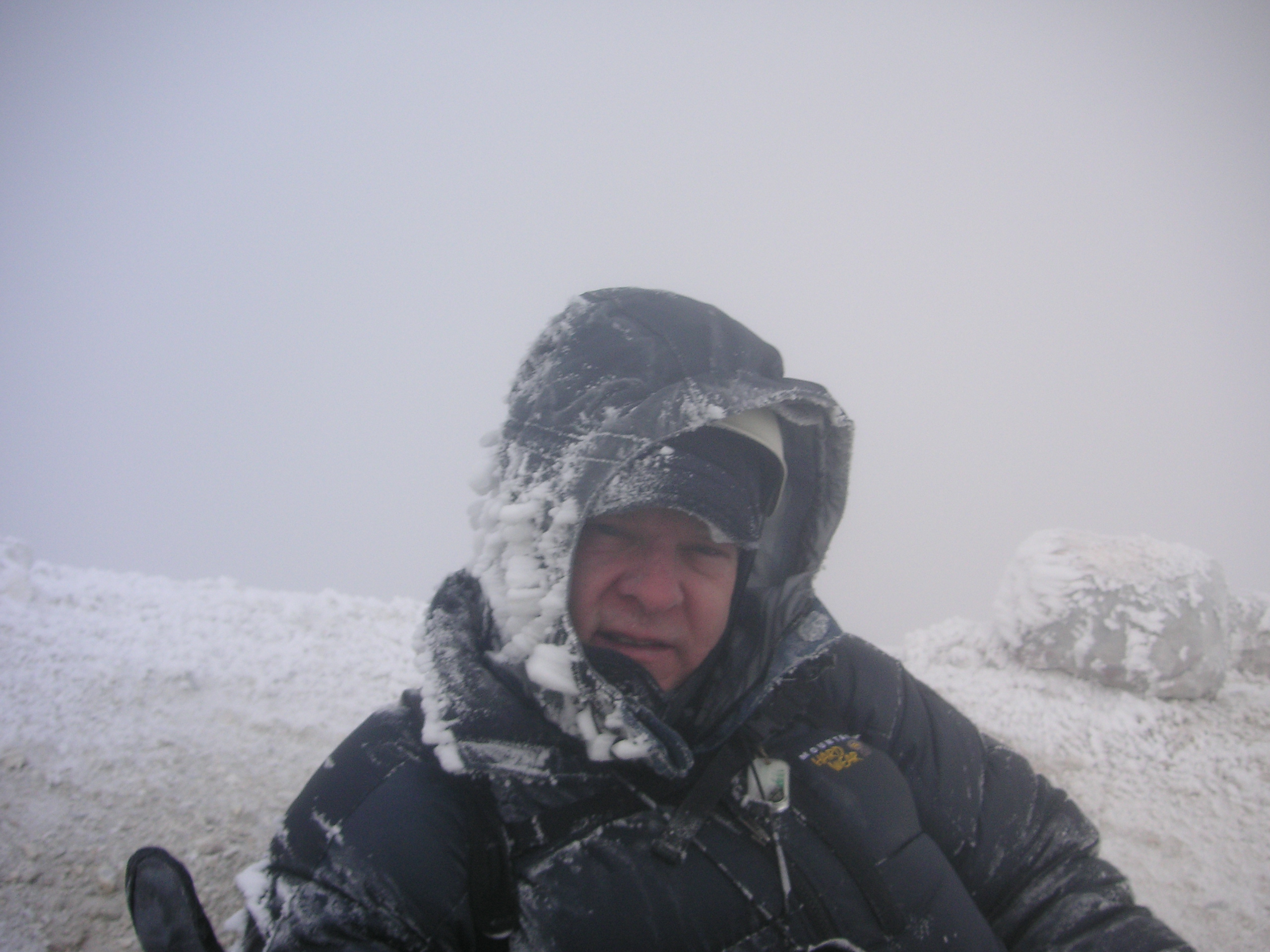
Saturday, 02/26/05, 10:22 a.m., around 18,300 feet. Alfredo (our guide) and I reached the summit crater around 10:00 a.m.; we found this small indentation to sort of lie in to get some relief from the high winds. We took these pictures the second time we rested in this indentation. To get to the actual summit we had to go a bit counterclockwise around the summit crater to the high point about 100 vertical feet above us, but when we tried to go, the wind and snow was so heavy that Alfredo said it was not safe because we could not see well enough. Directly behind me drops off and that is the way we came up the glacier. Directly behind Alfredo drops off into the summit crater.
If you want to hear how loud the wind was, hit the play button. I am saying "OK this is Alfredo and we're at the crater rim. Couldn't quite make it to the summit, but we got pretty close."
|
|
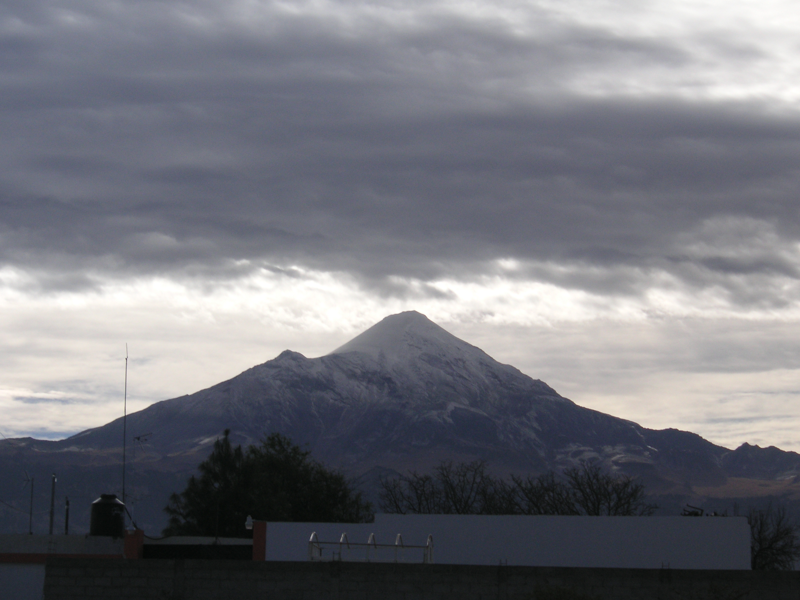
Sunday, 02/27/05, 8:35 a.m. from outside our hotel in Tlachichuca (8,500 feet). The day after. Note that now there is a whole lot more snow on the mountain. That snow got there while we were climbing it! Guess we really should have tried on Friday? But then again I have always liked the saying: "that which does not kill us makes us stronger".
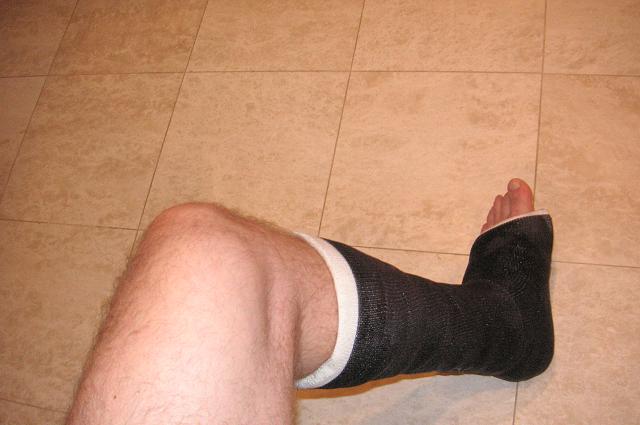
Friday, 03/11/05, 6:18 p.m., back in my kitchen. Oh by the way, there was one little mishap on the way down. After we got down off the glacier we took a break at around 16,500 feet to take off our crampons, etc. During the break, while Alfredo was out looking for our poles, I managed to step on some ground that completely gave way and I fell and injured my ankle. I guess that thinking the hard part was behind us, I let my guard down... Note to self: do not ever let your guard down! It took me about 5 hours to walk down on my injured ankle from 16,500 feet to the hut (and 4-wheel drive vehicle) at 14,000 feet. Turns out it was a "left distal fractured fibula". Ooops!
No worries, I tried some indoor rock climbing last night (03/10/05) and did some 5.9's and a 5.9+. The cast came off April 6, 2005. Next January: Aconcagua (22,841 feet)!!!
Cheers,
Steven